Also serving the communities of De Luz, Rainbow, Camp Pendleton, Pala and Pauma
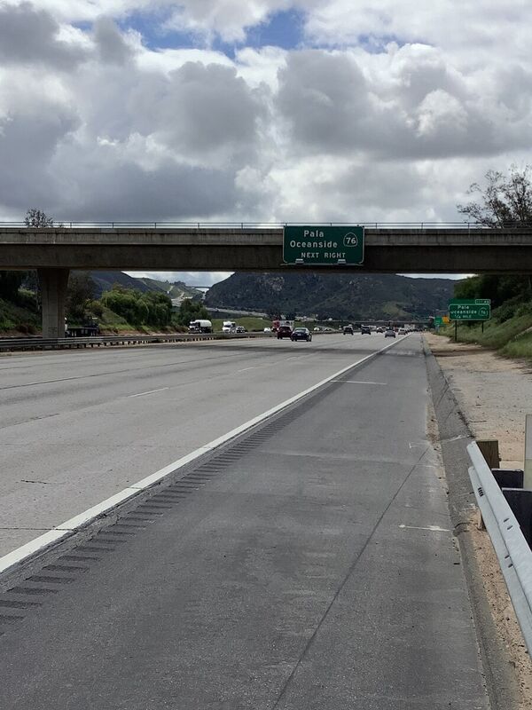
The bridge to nowhere....

That is what I have called it for decades...

When I began asking questions about the bridge over the 15 across from Pala Mesa, even the Caltrans worker said, "Oh, the bridge to nowhere..."

My family moved to Bonsall in 1978. We watched the area grow... we watched the two-lane 395 get bypassed by the huge, multi-lane I-15. We saw the elegant "rainbow bridge" (Lilac Road) be built over the carved-out summit.

Then, decades later, we moved up to Murrieta and were teased for decades by the widening of the 76 Highway. Now, luckily only one day a week, I sit in the stop-n-go traffic on my way home from Rainbow all the way to the 215 junction/split (which is currently in the process of its construction widening)...

All that to say (and then ask the big question), have you noticed that there is a bridge over the 15 near Pala Mesa Golf Course... that has never been used?!

There are big green mileage signs on both sides... and you've probably driven under it a thousand times, like I have, without really noticing it...

It is officially known as Structure number 57 08973 and it is a two-lane, 8.5 meter long... bare road.

It was completed in 1981 with "plans" to have 400 crossings per day in the year 2040...

But what about zero crossings today?

The NBI report says the bridge is in "fair" shape, and the deck and substructures are in "good" condition (but I walked it and it looks excellent); however, it remains impassable (see trees in pictures). Why? Especially with the huge housing developments built on the east and west sides of the freeway in the past few years.

I am certain that the residents of Pala Mesa are glad that no extra traffic bogs them down on their side of the frontage road...but the homeowners in the Aurora Heights and Citro/Tri Point developments sure wish they had another way in and out of their communities (as well as the Palomar College campus, staff, and students).

The deck geometry and railings are rated "meeting currently acceptable standards" but the approach transitions do not (meaning... there aren't any).

Its "pressed concrete continuous" surface also contains a pedestrian sidewalk (that are currently weed-free and only mildly graffitied).

Finally, who owns it and is supposed to maintain it? The California State Highway Agency was the one originally responsible... so I called them for a status and update: email sent on March 6. Passed along to SD District 11 and the passed onto SD Caltrans. Phone call made on March 7.

I finally heard back on March 20 with this pathetic response, "A project was approved in 2014 that will build a subdivision in the area. The development will use this bridge and provide a signalized intersection at Old Highway 395." Well, thanks a lot for that update.

They inspect it every two years (to make sure it isn't going to collapse on the I-15, I assume) and its next lookover should be this June. So, we shall wait, with bated breath and subconscious oblivion as we zip underneath the "bridge to nowhere" on our way down to San Diego or up to Corona a thousand more times (without ever overpassing on it east to west or vice versa...).

Oh, why the delay in finishing this article? I did find out that the CalSTA (California State Transportation Agency) is also the umbrella over the DMV and the High-Speed Rail Authority...and is located in Sacramento...so that explains a lot!


Reader Comments(0)